Configuring ArcGIS Online Maps with Flowfinity apps
Guest Contributor: Mike Pittinger, Superintendent, Metropolitan Sewer District of Greater Cincinnati
Flowfinity's deep linking features support client-side integration with third party apps on mobile devices. One popular use case is integrating ESRI's ArcGIS mapping software with Flowfinity mobile apps on-device for advanced data collection and workflow.
Example
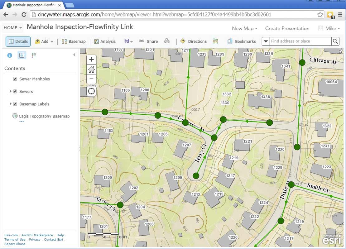
The City of Cincinnati's Wastewater Collection Division is responsible for managing and maintaining the city's sewer infrastructure and providing customer service for over 1 million residents and businesses. The division uses Flowfinity apps to collect data and guide field technicians through complex workflows on mobile devices, and ESRI to manage and map the city's assets. Flowfinity and ArcGIS are integrated for transitioning between mobile forms where information is documented, and assets on maps that are being worked on or inspected.
- Start by configuring a web map in ERSI's ArcGIS platform. The map should contain at least one Layer with defined attributes that you wish to use to populate fields within the records of a specific Flowfinity Actions app. In the example below, the "Sewer Manholes” layer includes attributes of {MH_Number} and {AssetID} - along with many others. In creating the Flowfinity app, fields to be populated from the map layer attributes were given the same field names in the Flowfinity app (MHInspection) to make configuring the URL links easier.
- Select the map layer (or layers) that you wish to use to trigger the creation of a Flowfinity Actions app record. In this case, the "Sewer Manholes” layer.
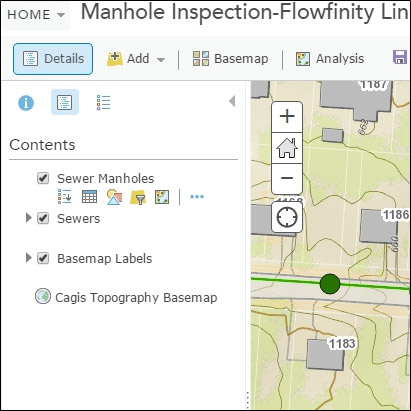
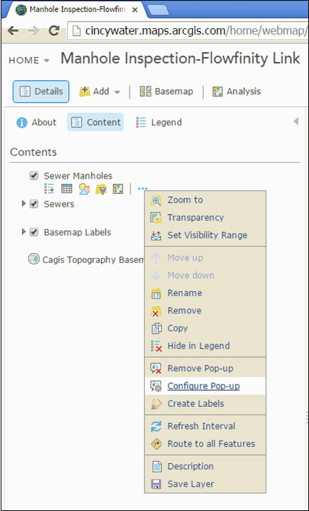
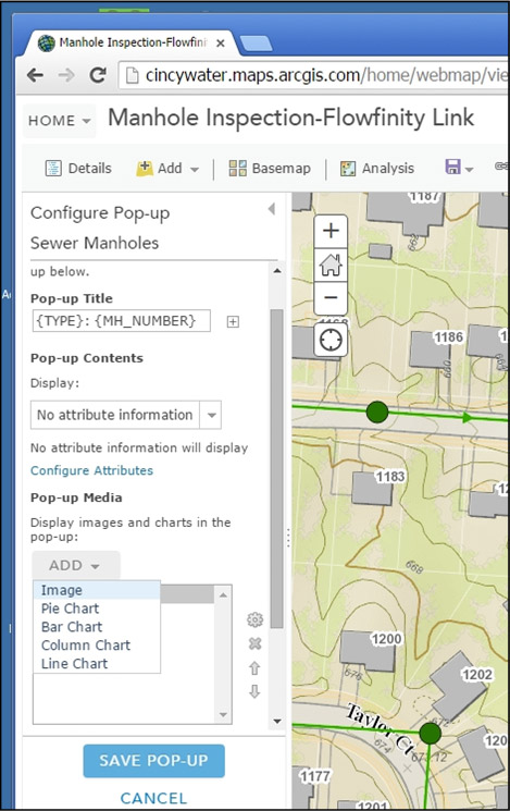
- After expanding the map layer that you wish to use under Contents, click on the three dots on the far right (shows "More Options” on mouse hover).
- Select Configure Pop-up from the dropdown menu.
-
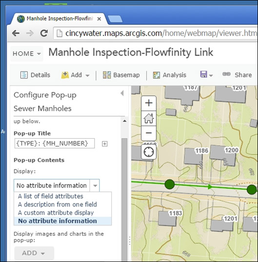
- Add a Pop-up Title - optionally using attribute fields in the map layer.
- Pick an option from the dropdown list of options for the Pop-up Contents. Any of the four options can be selected from this dropdown based upon display preferences, but note that configuring a flow:// URL through the "custom attribute display” will not save properly when the map is published, and will not support the URL deep-linking with Flowfinity.
- Under the Pop-up Media section, select the "Add” dropdown, and pick "Image”
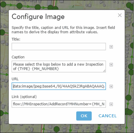
- Optionally specify a Title
- Optionally include a Caption that may include attributes from the map layer
- Include a URL to an Image that will display in the pop-up box. Note that this is mandatory for this method to work properly.
- Configure the Link entry to call the desired Flowfinity app, and map the ESRI attribute fields to the Flowfinity app fields. Note that the Link field is optional to save the popup in ArcGIS, but absolutely mandatory to integrate ArcGIS with Flowfinity.
- Hit OK when complete
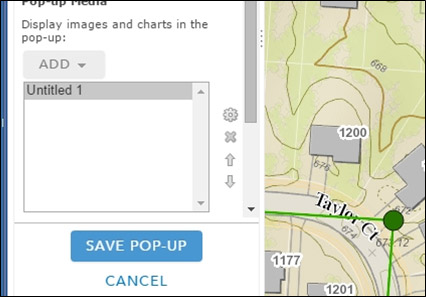
- Under the Pop-up Media section, select the "Add” dropdown, and pick "Image”
- Hit "SAVE POP-UP”,
- SAVE your ArcGIS map,
- SHARE your ArcGIS map (if not already shared)
-
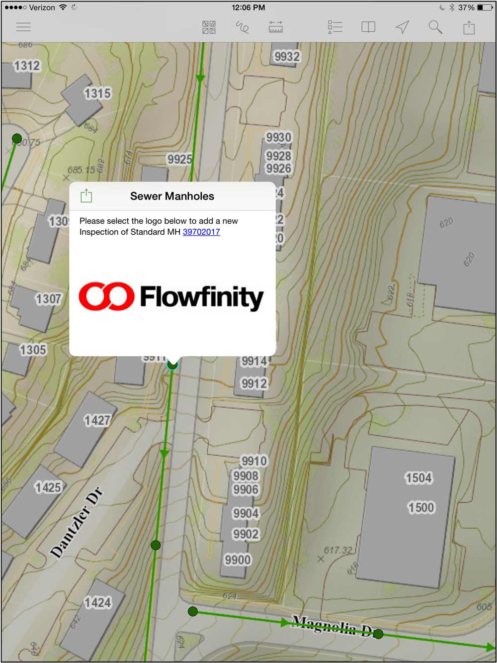
- Open Explorer for ArcGIS on your mobile device, and open the appropriate map with the configured layer
- Pick a feature from the configured layer on the map, and the pop-up box will display consistent with your preferences (shown in Explorer for ArcGIS on an iPad)
- Pick the "Image” in the pop-up box (in this example: the Flowfinity logo). This will open the Flowfinity client on the mobile device, open the appropriate Flowfinity app, and populate fields in the app with values from the map layer.
Note that multiple "Images” could be configured in the same ArcGIS pop-up with different Links. This could be valuable if you wanted to include a Flowfinity link for Mobile Devices, and another for desktop (browser) Flowfinity integration. The user would merely pick the appropriate link for their platform.